

Millions Warned to Remain Vigilant as Tornado Watch is Issued Over Five States
Millions of citizens have been alerted to “be prepared” as a strong storm moves across five states, resulting in power loss and flooding.
Severe Thunderstorm Warning for… Northeastern Knox County in southeastern Kentucky… Southeastern Owsley County in southeastern Kentucky… Leslie County in southeastern Kentucky… Perry County in southeastern Kentucky… Northwestern Knott County in southeastern Kentucky…… pic.twitter.com/WpAVkPg53g
— Tornado Central (@convectweather) February 16, 2025
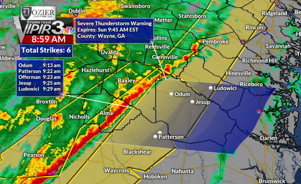
The National Weather Service (NWS) has predicted severe thunderstorms for Sunday, affecting northwestern Georgia, southern Tennessee, northwestern Florida, southern Mississippi, and parts of Alabama.
Tornado Watch & Safety Advisory
Residents in the affected areas are advised to “be prepared to act fast” if there is a tornado warning or they feel that threatening weather conditions exist.
The NWS advises residents to “be prepared” and “know your safe place.”
- Georgia: 59 counties under tornado watch through 9 a.m. EST Sunday.
- Mississippi: Harrison and Jackson counties under watch through 4 a.m. CST.
- Alabama: Central regions in watch until 6 a.m. CST.
- Florida: Bay, Gadsden, Jackson, and other counties in watch until 10 a.m. CST.
Our squall line continues to move very rapidly to the east bringing with it very gusty and damaging winds, isolated tornadoes and very heavy rainfall. If you are in any of these tornado or severe thunderstorm warnings seek shelter immediately #MSwx #ALwx #GAwx #TNwx #severewx pic.twitter.com/G9mO50AQR1
— severewxguy (@weathermandan10) February 16, 2025
Storm Impact & Widespread Power Outages
The storm has already caused widespread power outages due to strong winds and saturated ground, exposing trees and power lines to vulnerabilities.
Flash flooding continues to be a top concern throughout north Georgia, with a 2 out of 4 risk level, as rainfall remains heavy in the area.
In Middle Tennessee, communities saw flash flooding on Saturday, with six inches of rain falling. Clarksville saw four inches of rain, with two more inches anticipated.
Authorities & Emergency Response
- Tennessee State Troopers asked motorists to drive cautiously on roads.
- Clarksville’s street department placed 1,000 sandbags and barricades in areas prone to flooding.
- The NWS issued a warning on X that “excessive runoff can cause flooding of rivers, creeks, and low-lying areas.”
With gusts reaching as high as 40 mph, authorities are preparing for further severe weather threats. Citizens of the affected states are advised to remain informed and exercise caution.
You May Like: Author Ashley St. Clair Claims to Be Mother of Elon Musk’s 13th Child